 BIG Catalogue
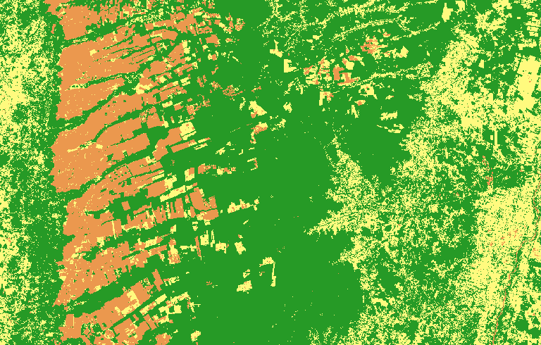
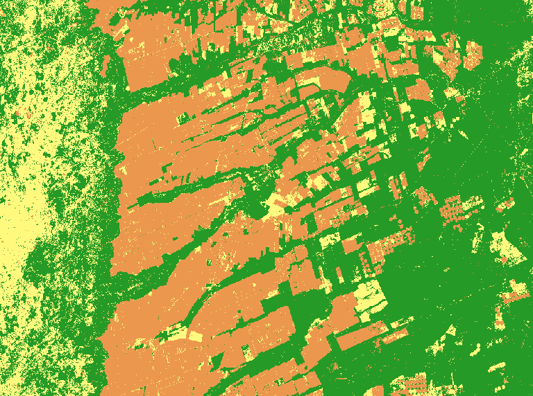
LCC CBERS-4 1M STK Bahia - Natural, Semi-perenial Crop, Annual Crop and Pasture
This land cover classification refers to a study area in Bahia state, in the Cerrado biome. For this map, the CBERS-4/AWFI monthly data cube was used, with a spatial resolution of 64 meters, using the best pixel composition function (Stack). This experiment uses the time series of an agricultural calendar year, from September 2018 to August 2019, extracted from the CBERS-4/AWFI data cube. The classification was made using 922 samples (Pasture: 258; Agriculture: 242; Natural Vegetation: 422) and the following data cube bands: red, green, blue, and near-infrared (NIR) along with the NDVI and EVI indices. We trained a multi-layer perceptron for a deep learning classification network to classify the data cube using sits R package. Validation was done using good practice guidelines by Olofsson. The validation was done independently for each map using the PRODES Cerrado data of 2019. This data obtained overall accuracy (OA) 0.74. For more information see the paper "Earth Observation Data Cubes for Brazil: Requirements, Methodology and Products".
To access this resource in GeoTIFF format it is necessary to have an access key provided by the BDC-OAuth service.
Simple
Identification info
- Date (Publication)
- 2021-01-03
- Status
- Completed
- Theme
-
-
lcc
-
classification
-
data-cube-classification
-
data-cube-cbers4-wfi
-
Uso e cobertura da Terra
-
Mapa
-
DIOTG
-
BDC
-
CBERS-4
-
Bahia
-
- Place
-
-
Brazil Bahia State
-
Brazil
-
- Service Type
- COG-GeoTIFF Raster File
- Topic category
-
- Environment
))
- Coupling Type
- Tight
- OnLine resource
- LCC_C4_64_1M_STK_PA-SPC-AC-NA_v001_044048_2018-09-01_2019-08-31.tif ( FILE:RASTER )
- OnLine resource
- LCC_C4_64_1M_STK_PA-SPC-AC-NA ( OGC:WMS-1.3.0-http-get-capabilities )
- File identifier
- 57e7adbe-a701-4809-ae49-2f6f6f31814d XML
- Metadata language
- English
- Character set
- UTF8
- Hierarchy level
- Service
- Date stamp
- 2024-04-01T12:40:02
- Metadata standard name
-
ISO 19115:2003/19139
- Metadata standard version
-
1.0
Overviews
Spatial extent
Provided by