 BIG Catalogue
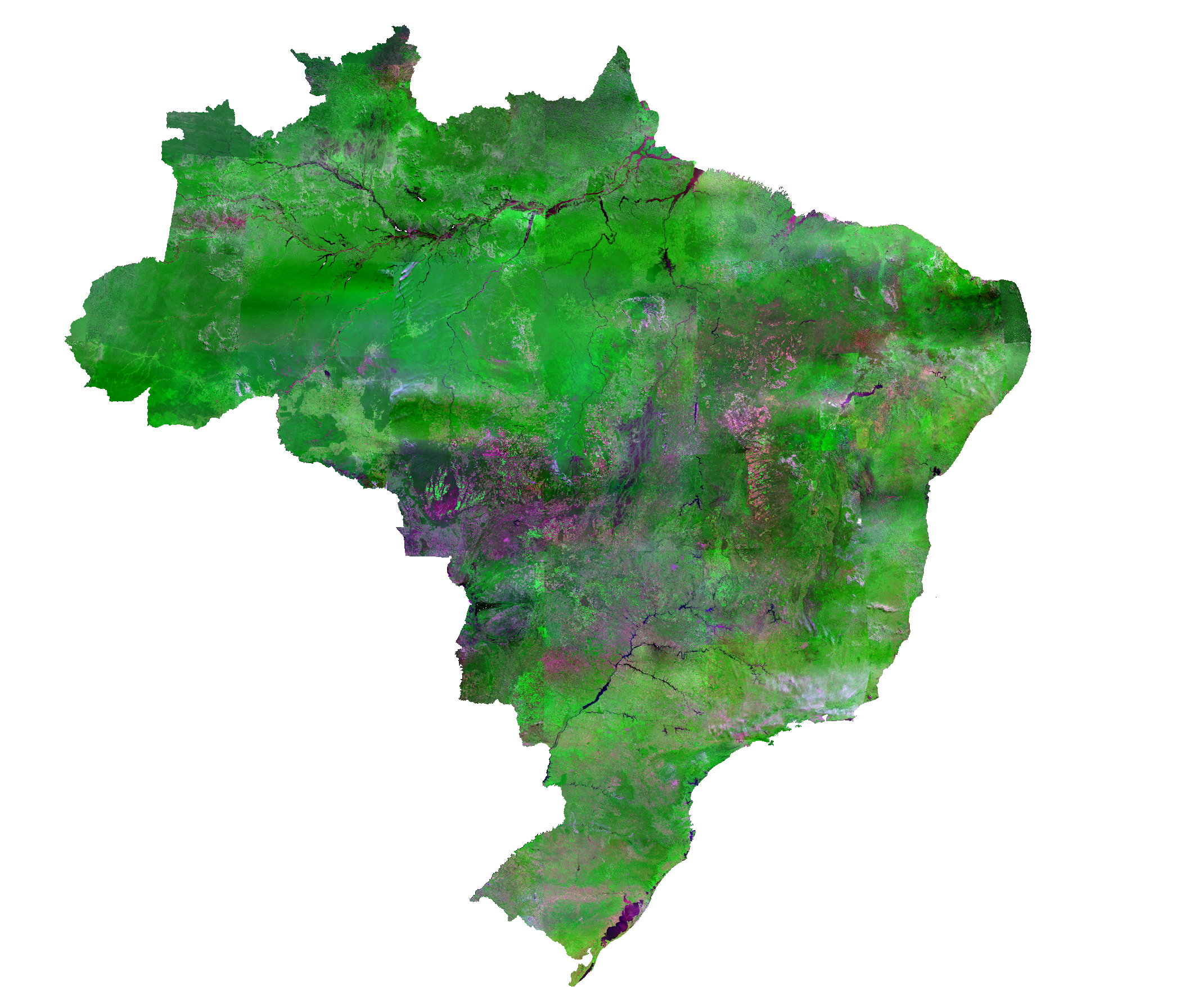
Brazil Data Cube - Brazil Mosaic - CBERS-4A
The CBERS-4 WFI Brazil Mosaic covers the entire Brazilian territory. The mosaic uses surface reflectance images from the CBERS satellite, a WFI imaging camera (or sensor) with 64 meters of spatial resolution. It is a composition of images from April to June 2020, selecting the best pixel within the period. The final product is an RGB color composite with the red (B15), NIR (B16), and blue (B13) bands.
Simple
Identification info
- Date (Publication)
- 2020-12-28
- Status
- Completed
- Theme
-
-
Mosaic
-
Composition
-
- Keywords
-
-
Brazil
-
CBERS-4
-
WFI
-
Brasil
-
CBERS-4A
-
BDC
-
DIOTG
-
Mosaico de imagens
-
Imagem colorida
-
- Service Type
- OGC:WMS
- Service Version
-
1.3.0
- Topic category
-
- Imagery base maps earth cover
N
S
E
W
))
- Coupling Type
- Tight
- OnLine resource
- CB4-MOSAIC-BRAZIL_64_3M_STK ( OGC:WMS-1.3.0-http-get-map )
- File identifier
- a214d8db-172a-4c41-bed8-3875c555323b XML
- Metadata language
- English
- Character set
- UTF8
- Hierarchy level
- Service
- Date stamp
- 2024-04-01T12:52:17
- Metadata standard name
-
ISO 19115:2003/19139
- Metadata standard version
-
1.0
Overviews
brazil.png
Spatial extent
N
S
E
W
Provided by

Associated resources
Not available