 BIG Catalogue
JSON
Type of resources
Available actions
Topics
Provided by
Formats
Representation types
Update frequencies
status
-
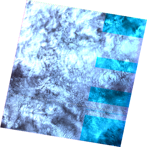
Copernicus Sentinel-3/OLCI Level-1B product OL_1_EFR (EO processing mode for Full Resolution) over Brazil.
-
South American Mapping of Temperature (SAMeT) is a newly developed product and operationally available for South America through the National Institute for Space Research (CPTEC / INPE) Weather Forecast and Climate Studies website. This product combines the observed data with the ERA5 reanalysis, making a correction of the temperature field using an estimated lapse rate. The Lapse Rate was estimated for four regions located over South America, and for the four seasons of the year. The estimated values for the Lapse Rate were, in all situations, lower than the standard Lapse Rate (-6.5 °C·km-¹). The combination of reanalysis and observations, together with the correction of the Lapse Rate produced more accurate temperature fields than those provided by ERA5, especially in regions with more accentuated topography.
-
The Aqua Moderate Resolution Imaging Spectroradiometer (MODIS) Land Surface Temperature/Emissivity 8-Day (MYD11A2) Version 6.1 product provides an average 8-day per-pixel Land Surface Temperature and Emissivity (LST&E) with a 1 kilometer (km) spatial resolution in a 1,200 by 1,200 km grid. Each pixel value in the MYD11A2 is a simple average of all the corresponding MYD11A1 LST pixels collected within that 8-day period. The 8-day compositing period was chosen because twice that period is the exact ground track repeat period of the Terra and Aqua platforms. Provided along with the daytime and nighttime surface temperature bands are associated quality control assessments, observation times, view zenith angles, and clear-sky coverages along with bands 31 and 32 emissivities from land cover types.
-
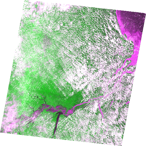
Copernicus Sentinel-1 Level-1 Ground Range Detected (GRD) products consist of focused SAR data that has been detected, multi-looked and projected to ground range using an Earth ellipsoid model. This dataset contains interferometric wide swath ground range detected high resolution data available over Brazil.
-
The Terra Moderate Resolution Imaging Spectroradiometer (MODIS) Land Surface Temperature/Emissivity 8-Day (MOD11A2) Version 6.1 product provides an average 8-day per-pixel Land Surface Temperature and Emissivity (LST&E) with a 1 kilometer (km) spatial resolution in a 1,200 by 1,200 km grid. Each pixel value in the MOD11A2 is a simple average of all the corresponding MOD11A1 LST pixels collected within that 8-day period. The 8-day compositing period was chosen because twice that period is the exact ground track repeat period of the Terra and Aqua platforms. Provided along with the daytime and nighttime surface temperature bands are associated quality control assessments, observation times, view zenith angles, and clear-sky coverages along with bands 31 and 32 emissivities from land cover types.
-
Satellite precipitation estimates combined with surface observations over South America. Satellite estimates for the first few hours are provided by the GPM-Early product. This dataset is provided in GRIB2 data format (https://www.nco.ncep.noaa.gov/pmb/docs/grib2/grib2_doc/).
-
CBERS-2B/CCD - Level-2 Digital Number product. Level 2 products have radiometric correction and geometric correction using satellite ephemeris and attitude data (system correction).
-
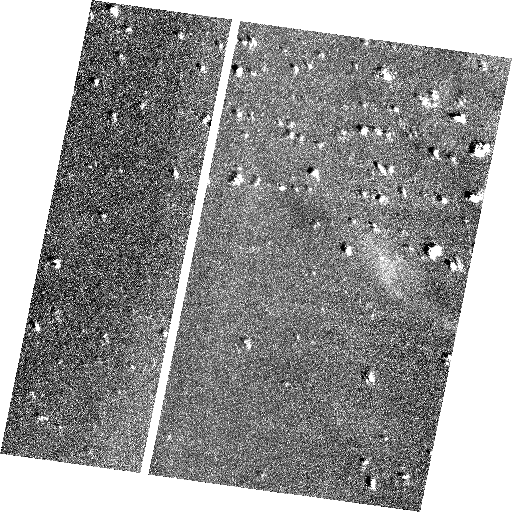
CBERS-2B/HRC - Level-2 Digital Number product. Level 2 products have radiometric correction and geometric correction using satellite ephemeris and attitude data (system correction).
-
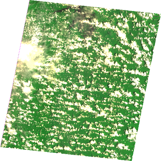
CBERS-2B/WFI - Level-2 Digital Number product. Level 2 products have radiometric correction and geometric correction using satellite ephemeris and attitude data (system correction).
-
CBERS-2/CCD - Level-2 Digital Number product. Level 2 products have radiometric correction and geometric correction using satellite ephemeris and attitude data (system correction).