 BIG Catalogue
Brazil Goiás State
Type of resources
Available actions
Topics
Keywords
Contact for the resource
Provided by
status
Service types
-
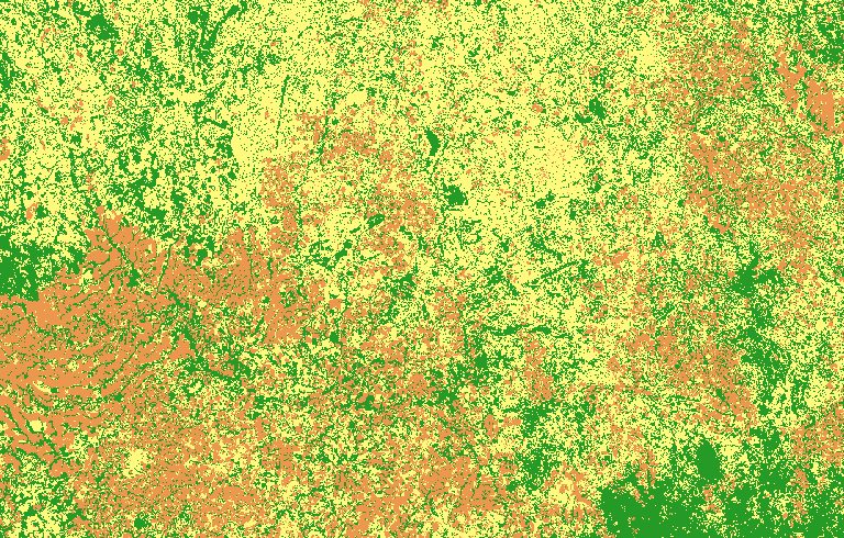
This land cover classification refers to a study area in Goiás state, in the Cerrado biome. For this map, the CBERS-4/AWFI monthly data cube was used, with a spatial resolution of 64 meters, using the best pixel composition function (Stack). This experiment uses the time series of an agricultural calendar year, from September 2018 to August 2019, extracted from the CBERS-4/AWFI data cube. The classification was made using 701 samples (Annual Crop: 299; Natural: 202; Pasture: 200) and the following data cube bands: red, green, blue, and near-infrared (NIR) along with the NDVI and EVI indices. We trained a multi-layer perceptron for a deep learning classification network to classify the data cube using sits R package. To access this resource in GeoTIFF format it is necessary to have an access key provided by the BDC-OAuth service.