The Brazil Data Cube project won a grant to improve the understanding of our planet
The “Brazilian Earth Observation Data Cube using AWS for Land Use and Cover Change” project was chosen among several proposals by the Group on Earth Observations (GEO) and the Amazon Web Services (AWS). It was awarded US$ 60,000 through the Earth Observation Cloud Credits Program
The winners were announced on Monday (10/06) in Washington, United States, during the AWS Public Sector Summit.
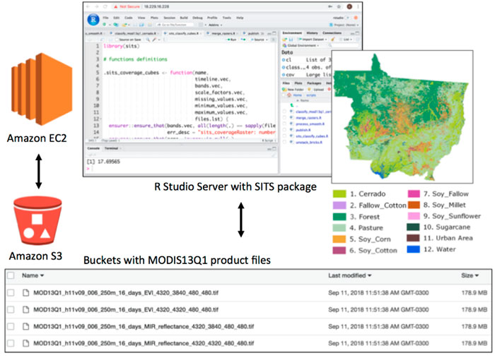
The goal of the INPE’s project is to compute, store and process large volumes of satellite images for the automatic generation of land use and cover maps of Brazil. AWS is now helping INPE to archive this goal.
The project team is led by researchers Karine Ferreira, Lubia Vinhas, Gilberto Queiroz, Ricardo Souza, Ieda Sanches, Claudio Almeida and Leila Fonseca, from INPE Earth Observation Coordination (OBT).
“This will increase our ability to work with cloud computing technology on a major issue for our area and for INPE,” says Karine Ferreira, leader of the project.
More information at:
https://aws.amazon.com/pt/blogs/publicsector/announcing-cloud-grants-to-improve-understanding-of-our-planet/
http://earthobservations.org/article.php?id=362
Source: AWS, INPE.


