Slide 1

Production, visualization and analysis of large volumes of remote sensing images modeled as multidimensional data cubes for the entire Brazilian territory.

Virtual hands-on training on sits at FOSS4G 2021 conference

On September 27th, 2021, Dr Gilberto Camara, one of the members of the BDC team, will conduct virtual hands-on training on the classification of remote sensing image time series using the R package software for Satellite Image Time Series (sits) at FOSS4G (Free and Open Source Software for Geospatial) 2021 conference. The FOSS4G conference is …

Brazil Data Cube project team teaches course for IBGE and National School of Statistical Sciences

A equipe do projeto Brazil Data Cube (BDC), coordenada pelos servidores da DIOTG Gilberto Queiroz e Karine Ferreira, ministrou essa semana nos dias 09 e 10 de setembro de 2021 o curso “Descoberta e acesso aos dados do projeto BDC usando serviços web e análise e classificação de séries temporais de imagens” para o Instituto …

Brazil Data Cube team will present a mini-course at WorCAP 2021

The Brazil Data Cube (BDC) project team will present on September 15th, 2021, the mini-course: “Introduction to STAC and WTSS” within the WorCAP 2021. The 04-hour mini-course aimed to present an introduction to the concepts of time series and data cubes, as well as how to use, through Python language, the services Spatio Temporal Asset …

Brazil Data Cube team will attend the GISFOREST Workshop

The BDC team will present the project in the International Workshop on Forest Geotechnologies (GISFOREST), on September 1st. GISFOREST is an event of innovations in geotechnologies for forest applications. This is the second edition and will take place online, from August 31st to September 2nd. The registrations can be made on the event website. Source: …

Brazil Data Cube team will attend the MundoGEO Connect

The Brazil Data Cube team will attend the MundoGEO Connect event, tomorrow, August 19th, at 2 pm. The lecture about the project will be in the panel: Images, Artificial Intelligence, Machine and Deep Learning, with the theme: “Brazil Data Cube Project: Image data cubes, big data, time series analysis and machine learning”. The event is …

BDC team will attend the IGARSS-2021 Symposium this week

The BDC team will attend on July 13th the International Geoscience and Remote Sensing Symposium (IGARSS-2021) presenting the paper “RSTAC: An R package to access spatiotemporal asset catalog satellite imagery”. The package provides functions to access, search and download spacetime earth observation data via STAC and is published in the CRAN.’ The paper and presentation will be …

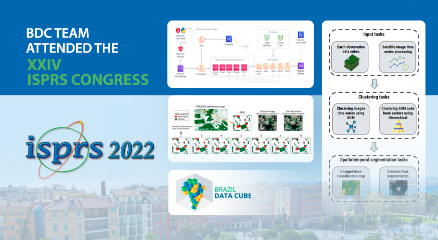
BDC’s team will attend the XXIV ISPRS congress this week

The BDC team will attend the International Society for Photogrammetry and Remote Sensing Congress (XXIV ISPRS) with two paper presentations. The team will present the paper “Accessing and processing Brazilian Earth observation data cubes with the Open Data Cube platform” on July 6th and the paper “Evaluating the impact of LaSRC and Sen2cor atmospheric correction …

New publication by the Brazil Data Cube team

The associate researcher Rolf Simoes, from the Brazil Data Cube project, published the article “Satellite Image Time Series Analysis for Big Earth Observation Data” at the Remote Sensing journal, with his OTG advisors Gilberto Queiroz and Gilberto Camara, and other project members. The article is the result of his PhD on Applied Computing at INPE. …

Live demonstration of SITS with SEPAL platform in the GEO-GFOI Workshop

The BDC team will present tomorrow (June, 16th) in the GEO-GFOI Workshop a live demonstration of the R package SITS (Satellite Image Time Series Analysis) running in the SEPAL platform. SITS is an open source R package for satellite image time series analysis and machine learning. It supports the complete cycle of data analysis for …

Two Landsat-8/OLI image mosaics of Brazil are available on the Brazil Data Cube Portal

Two image mosaics of Brazil was launched today by the Brazil Data Cube project team. These mosaic were generated from Landsat-8/OLI images, surface reflectance, with 30 meters of spatial resolution. These mosaics were generated by selecting best pixels (free of clouds and cloud shadows) in two periods of 6 months: (1) July 2017 to December …

Brazil Data Cube - 2019 - 2025