Comparison of Cloud Cover Detection Algorithms on Sentinel–2 Images of the Amazon Tropical Forest
by Alber Hamersson Sanchez 1,, Michelle Cristina A. Picoli 2, , Gilberto Camara 2, , Pedro R. Andrade 1, , Michel Eustaquio D. Chaves 3,, Sarah Lechler 4, Anderson R. Soares 2, Rennan F. B. Marujo 2, Rolf Ezequiel O. Simões 2, Karine R. Ferreira 2 and Gilberto R. Queiroz 2
1Earth System Science Center, National Institute for Space Research—INPE, São José dos Campos 12227-010, Brazil
2Image Processing Division, National Institute for Space Research—INPE, São José dos Campos 12227-010, Brazil
3Remote Sensing Division, National Institute for Space Research—INPE, São José dos Campos 12227-010, Brazil
4Institute for Geoinformatics, University of Münster, 48149 Münster, Germany
Remote Sens. 2020, 12(8), 1284; https://doi.org/10.3390/rs12081284
Publisher: mdpi | Published: 18 April 2020
(This article belongs to the Special Issue Assessing Changes in the Amazon and Cerrado Biomes by Remote Sensing)
Abstract
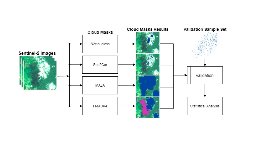
Tropical forests regulate the global water and carbon cycles and also host most of the world’s biodiversity. Despite their importance, they are hard to survey due to their location, extent, and particularly, their cloud coverage. Clouds hinder the spatial and radiometric correction of satellite imagery and also diminishing the useful area on each image, making it difficult to monitor land change. For this reason, our purpose is to identify the cloud detection algorithm best suited for the Amazon rainforest on Sentinel–2 images. To achieve this, we tested four cloud detection algorithms on Sentinel–2 images spread in five areas of the Amazonia. Using more than eight thousand validation points, we compared four cloud detection methods: Fmask 4, MAJA, Sen2Cor, and s2cloudless. Our results point out that FMask 4 has the best overall accuracy on images of the Amazon region (90%), followed by Sen2Cor’s (79%), MAJA (69%), and S2cloudless (52%). We note the choice of method depends on the intended use. Since MAJA reduces the number of false positives by design, users that aim to improve the producer’s accuracy should consider its use. View Full-Text
Keywords: remote sensing; amazon forest; clouds; Sentinel–2; Fmask; Sen2Cor; MAJA; s2cloudless
© This is an open access article distributed under the Creative Commons Attribution License which permits unrestricted use, distribution, and reproduction in any medium, provided the original work is properly cited


