Integrating Open Data Cube and Brazil Data Cube Platforms for Land Use and Cover Classifications
by Felipe Menino Carlos¹, Vitor Conrado Faria Gomes², Gilberto Ribeiro de Queiroz¹, Felipe Carvalho de Souza¹, Karine Reis Ferreira¹ and Rafael Santos¹
1National Institute for Space Research (INPE), Earth Observation and Geoinformatics Division, São José dos Campos –SP, Brazil.
²Institute for Advanced Studies (IEAv), C4ISR Division, São Josédos Campos –SP, Brazil. vitorvcfg@fab.mil.br.
DOI: http://dx.doi.org/10.14393/rbcv73n4-60387
Publisher: Revista Brasileira de Cartografia | 18 October 2021
Abstract
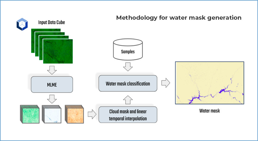
The potential to perform spatiotemporal analysis of the Earth’s surface, fostered by a large amount of Earth Observation (EO) open data provided by space agencies, brings new perspectives to create innovative applications. Nevertheless, these big datasets pose some challenges regarding storage and analytical processing capabilities. The organization of these datasets as multidimensional data cubes represents the state-of-the-art in analysis-ready data regarding information extraction. EO data cubes can be defined as a set of time-series images associated with spatially aligned pixels along the temporal dimension. Some key technologies have been developed to take advantage of the data cube power. The Open Data Cube (ODC) framework and the Brazil Data Cube (BDC) platform provide capabilities to access and analyze EO data cubes. This paper introduces two new tools to facilitate the creation of land use and land over (LULC) maps using EO data cubes and Machine Learning techniques, and both built on top of ODC and BDC technologies. The first tool is a module that extends the ODC framework capabilities to lower the barriers to use Machine Learning (ML) algorithms with EO data. The second tool relies on integrating the R package named Satellite Image Time Series (sits) with ODC to enable the use of the data managed by the framework. Finally, water mask classification and LULC mapping applications are presented to demonstrate the processing capabilities of the tools.
Keywords: Earth observation data cube, Land use and land cover classification, Open data cube, Brazil data cube.
Share and Cite
Carlos, F.M., Gomes, V.C.F., Queiroz, G.R., Souza, F.C., Ferreira, K.R., Santos, R.. Integrating Open Data Cube and Brazil Data Cube platforms for land use and cover classifications. Revista Brasileira de Cartografia, v73, 1036–1047, 2021. DOI.


