Land Cover Classifications of Clear-cut DeforestationUsing Deep Learning
by Alber Sanchez¹, Michelle Picoli²,Pedro R. Andrade¹, Rolf Simões², Lorena Santos², Michel Chaves³, Rodrigo Begotti², Gilberto Camara²
1 – Centro de Ciência do Sistema Terrestre – Instituto Nacional de Pesquisas Espaciais
(INPE) Av. dos Astronautas, 1758 – 12.227-010 – São José dos Campos – SP – Brazil
2 – Divisão de Processamento de Imagens – Instituto Nacional de Pesquisas Espaciais
(INPE) Av. dos Astronautas, 1758 – 12.227-010 – São José dos Campos – SP – Brazil
3 – Divisão de Sensoriamento Remoto – Instituto Nacional de Pesquisas Espaciais (INPE)
Av. dos Astronautas, 1758 – 12.227-010 – São José dos Campos – SP – Brazil
ISSN: 2179-4847
Publisher: XX GEOINFO | Published: 13 November 2019.
Abstract
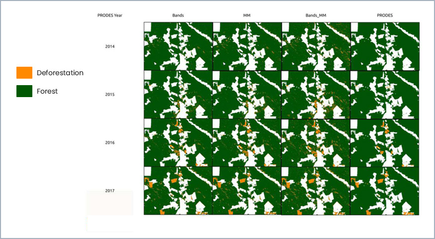
Using Deep Learning Neural Networks, we made supervised classifications of a small region of the Brazilian Amazon in order to map clearcut deforestation. We organized Landsat 8 Surface Reflectance images into time series and we classify the images using the bands ad a Linear Mixture Model. We obtained similar accuracies using both data sets when compared to the data reported by the Brazilian Amazon Deforestation Monitoring Program (PRODES). These results suggest the possibilities of using automatic supervised techniques to extend the coverage of forest monitoring programs to those excluded areas by lack of human resources.
Keywords: geoinformatica, land cover classifications, deep learning
© This is an open access article distributed under the Creative Commons Attribution License which permits unrestricted use, distribution, and reproduction in any medium, provided the original work is properly cited
Share and Cite
SANCHEZ, A.; PICOLI, M.; ANDRADE, P. R.; SIMÕES, R.; SANTOS, L.; CHAVES, M.; BEGOTTI, R.; CAMARA, G. Land cover classifications of clear-cut deforestation using deep learning. In: SIMPÓSIO BRASILEIRO DE GEOINFORMÁTICA, 20. (GEOINFO), 2019, São José dos Campos. Anais do 20º Simpósio Brasileiro de Geoinformática… São José dos Campos: INPE, 2019. On-line. ISSN 2179-4847. IBI: <8JMKD3MGPDW34R/3UFDE4P>. Disponível em: http://urlib.net/ibi/8JMKD3MGPDW34R/3UFDE4P.


