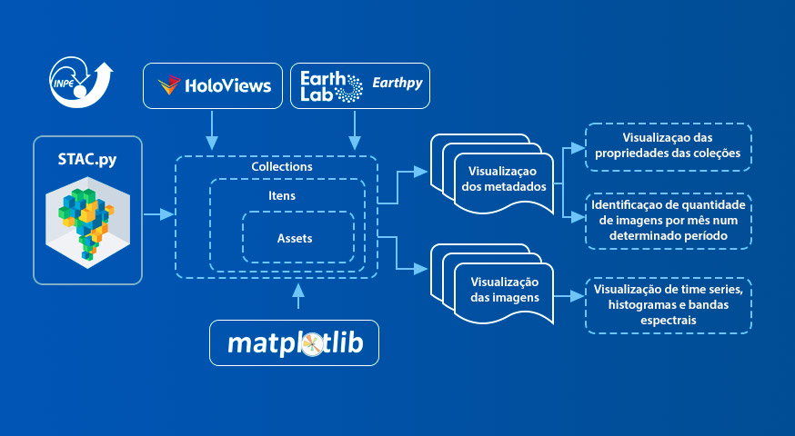
Utilizando o padrão SpatioTemporal Asset Catalog para visualização de dados.
by Thais de Medeiros¹, Bruno dos Santos¹, Gilberto Oliveira¹, Thales Korting², Gilberto de Queiroz²
¹Programa de Pós Graduação em Sensoriamento Remoto – Instituto Nacional de Pesquisas Espaciais (INPE) – São José dos Campos, SP – Brasil
²Divisão de Observação da Terra e Geoinformática – Instituto naional de Pesquisas Espaciai (INPE) – São José dos Campos, SP – Brasil
Publisher: Anais do 22º GEOINFO | Published: 2 December 2021
Abstract
The Brazil Data Cube project (BDC) is an initiative aiming at the production of the multidimentional data cube, analysis-ready data, through images obtainde by satellites. In addition to data products, the BDC also has systems created to facilitate access to its data collection. Among the services offered, the SpatioTemporal Asset Catalog (STAC) stands out, focused on cataloging image metadata form sensors. In this sense, this work produced datata visualization features from the STAC.py library. For viewing the BDC collections, a new class was created to render information in HTML format. They were used the Matplotlib, Earthpy, and Holoviews libraries, both for visualization of metadata sumarizations, as well as for visualization of images and histograms.
Keywords:
© This is an open access article distributed under the Creative Commons Attribution License which permits unrestricted use, distribution, and reproduction in any medium, provided the original work is properly cited


