
Integranting Analysis Methods During Land Use and Land Cover Sampling
by Abner Ernâni dos Anjos¹, Karine Reis Ferreira¹, Gilberto Ribeiro de Queiroz¹, Fabiana Zioti ¹, Gabriel Sansigolo¹
1National Institute for Space Research (INPE), Brazil
GeoInfo: http://mtc-m21d.sid.inpe.br/rep/8JMKD3MGP3W34T/488BPNL
Publisher: GeoInfo | Published: 29 November 2022
© Author(s) 2022. This work is distributed under the Creative Commons Attribution 4.0 License.
Abstract
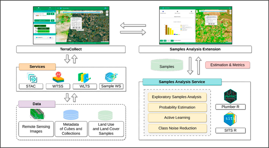
The Land Use and Land Cover (LULC) mapping based on machine learning requires collecting samples for the training of predictive models. This step is a time-consuming and expensive process, in addition this activity is subject to mislabeling samples. Therefore, several methods for quality assessment have been developed and applied successfully, but attaching the collect process with assessment becomes a challenge on some platforms. This article presents a work in progress that aims to integrate methods for sample analysis during the collection process in the TerraCollect system under development in the Brazil Data Cube.
Keywords: Earth Observation Data Cubes, Sample Analysis, Machine Learning, Land Use and, Land Cover Classification
Share and Cite
Anjos, A.E.; Ferreira, K.R.; Queiroz, G.R.; Zioti, F.; Sansigolo. G. Integranting Analysis Methods During Land Use and Land Cover Sampling. In: Brazilian Symposium on Geoinformatics (GEOINFO-2022), 247-252. Proceedings XXIII GEOINFO, November 28 to 30, 2022. São José dos Campos, SP, Brazil. INPE, 2022. ISSN 2179-4847.
http://mtc-m21d.sid.inpe.br/rep/8JMKD3MGP3W34T/488BPNL