
Using Earth Observation Data Cube to Mapping Burned Areas
by Mateus de Souza Macul¹, Wesley Campanharo¹, Fabiano Morelli¹, Gilberto Ribeiro de Queiroz¹, Karine Reis Ferreira¹
1National Institute for Space Research (INPE), Brazil
GeoInfo: http://mtc-m21d.sid.inpe.br/rep/8JMKD3MGP3W34T/488BPNL
Publisher: GeoInfo | Published: 29 November 2022
© Author(s) 2022. This work is distributed under the Creative Commons Attribution 4.0 License.
Abstract
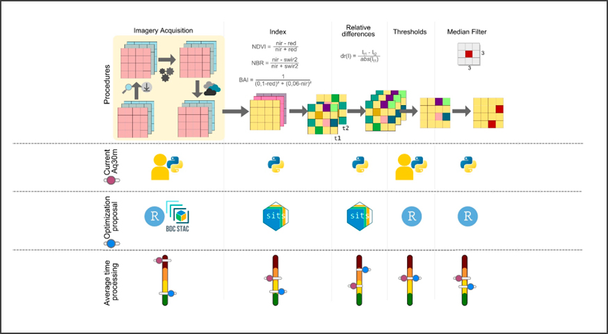
Earth observation data cubes are multidimensional structures created from Analysis-Ready Data (ARD) of remote sensing images. This work presents the use of data cubes in the mapping of burnt area using the methodology of the product aq30m of the INPE’s Queimadas Program. Tests were conducted in two different areas and at different scales in the Cerrado biome. The methodology was adapted to use the data cubes and the technologies developed by the Brazil Data Cube (BDC) project in R language. Subsequently, the results were compared with the original aq30m data and the advantages of using data cubes in burned area mapping were verified, enabling future improvements.
Keywords: burned area, EO data cubes, Brazil Data Cube
Share and Cite
Macul, M.S.; Campanharo, W.; Morelli, F.; Queiroz, G.R.; Ferreira, K.R. Using Earth Observation Data Cube to Mapping Burned Areas. Brazilian Symposium on Geoinformatics (GEOINFO-2022), 264-269. Proceedings XXIII GEOINFO, November 28 to 30, 2022. São José dos Campos, SP, Brazil. INPE, 2022. ISSN 2179-4847.
http://mtc-m21d.sid.inpe.br/rep/8JMKD3MGP3W34T/488BPNL