Identifying Spatiotemporal Patterns in Land Use and Cover Samples from Satellite Image Time Series
by Lorena Alves Santos 1,*,Karine Ferreira 1,Michelle Picoli 1,Gilberto Camara 1,Raul Zurita-Milla 2 and Ellen-Wien Augustijn 2
1Earth Observation and Geoinformatics Division, National Institute for Space Research (INPE), Avenida dos Astronautas, 1758, Jardim da Granja, Sao Jose dos Campos, SP 12227-010, Brazil
2Faculty of Geo-Information Science and Earth Observation (ITC), University of Twente, 7500 AE Enschede, The Netherlands
Academic Editor: Lluís Pesquer Mayos
Remote Sens.2021, 13(5), 974; https://doi.org/10.3390/rs13050974
Publisher: mdpi | Published: 4 March 2021
(This article belongs to the Special Issue Geospatial Statistics and Spatiotemporal Analysis Based on Remote Sensing Imagery)
Abstract
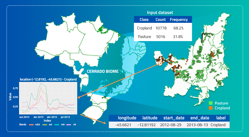
The use of satellite image time series analysis and machine learning methods brings new opportunities and challenges for land use and cover changes (LUCC) mapping over large areas. One of these challenges is the need for samples that properly represent the high variability of land used and cover classes over large areas to train supervised machine learning methods and to produce accurate LUCC maps. This paper addresses this challenge and presents a method to identify spatiotemporal patterns in land use and cover samples to infer subclasses through the phenological and spectral information provided by satellite image time series. The proposed method uses self-organizing maps (SOMs) to reduce the data dimensionality creating primary clusters. From these primary clusters, it uses hierarchical clustering to create subclusters that recognize intra-class variability intrinsic to different regions and periods, mainly in large areas and multiple years. To show how the method works, we use MODIS image time series associated to samples of cropland and pasture classes over the Cerrado biome in Brazil. The results prove that the proposed method is suitable for identifying spatiotemporal patterns in land use and cover samples that can be used to infer subclasses, mainly for crop-types.
Keywords: data training; time series; clustering; spatiotemporal patterns
© This is an open access article distributed under the Creative Commons Attribution License which permits unrestricted use, distribution, and reproduction in any medium, provided the original work is properly cited
Share and Cite
Santos, L.A.; Ferreira, K.; Picoli, M.; Camara, G.; Zurita-Milla, R.; Augustijn, E.-W. Identifying Spatiotemporal Patterns in Land Use and Cover Samples from Satellite Image Time Series. Remote Sens. 2021, 13, 974. https://doi.org/10.3390/rs13050974


